Thursday, July 31, 2008

End of a Good Thing

To soon, the month in Vancouver came to an end.

After the exertions of the Grouse Grind, I was glad that Ken had offered me a night off from the show. I took advantage of his offer and stayed home and made a big batch of cookies. I bagged up some and took them over to David's apartment shortly after nine. He and Karl skipped out on the second act and we all gathered on David's balcony to watch the first night of the HSBC Celebration of Light fireworks competition. Three countries (Canada, the US and China) each supplied a 20 minute fireworks show synchronized to music over English Bay over 3 nights with a winner picked by the assembled crowds announced before the fourth night's grand finale show. It's an annual event in Vancouver and drew big crowds to the shore. Wednesday's fireworks were presented by Canada and were given the theme of "Attack". The radio simulcast began with an emergency announcement that the city was under attack and continued with all kinds of instrumentals coordinated with the show in the sky. David's apartment was in the middle of downtown, so we could see the aerial display but only got hints of what was fired closer to the ground. The three of us really enjoyed our private show with some wine and no crowds!


The "attack" over Vancouver


Wayne, Roy and I visited the University of British Columbia's Botanical Gardens on Friday. The gardens are huge and varied. They were much less structured than any of the MSU Botanical Gardens I'm familiar with. A few of the gardens, such as the Alpine Garden and the medicinal garden, were formal feeling with individual plants set apart with signage; but much the garden felt like a walk in the woods. The mild climate in Vancouver allows the gardeners to grow a wide variety of plants from all over the world and integrate them with the native species. It was a very pleasant way to pass the afternoon - strolling on the garden paths and enjoying the natural beauty.


JV and Roy on one of the many little bridges


Roy and JV pose under the Chinese Moon Gate
(Thanks to Wayne for sharing his photos)


The weekend hurried by, as it always does, with two show days on Saturday and Sunday. I rushed to take advantage on my apartment's washer and drier so I could depart with a completely clean set of clothes. I also endeavoured to eat up a month's worth of left-overs in my fridge and cupboards. On Sunday, I packed by duffels and cleaned the apartment into the wee hours and still awoke extra early on Monday to finish up the cleaning before I had to check-out at 7:30 to be on the way to the airport for my early flight to Edmonton.


I adored my apartment in Vancouver. It was a great home away from home and grew quite comfortable there. It certainly helped that Sheila Marie spent the first week there with me, so I could easily picture the two of us there together. It was just the right size for me with a separate bedroom and a tiny office nook for my paperwork and computer. The balcony was big and I spent many nights outside on the phone with Sheila Marie and a glass of wine. You can get an idea of the place on the realtor's listing here.


989 Beatty Street - my home in Vancouver


As we packed up the show on Sunday, it was time to say goodbye to the Vancouver crew. We became attached to a few of the locals - they were one of the most welcoming bunches of people we've worked with in a while. Several of them turned up on Spamily outings and were, as often as not, welcome additions. The stage left local prop person, Kat, is definitely one of my favorites from the 17 months I've been on the road. She was super capable and friendly. I tried to convince Vera to hide her in hamper and bring her along... One of our local carps was also quite a character. Al has been a stage hand, seemingly, forever. (The houselight guy had this to say to Al in an overheard conversation: "Now, Al, I know you were the head carp at the crucifixion...") He was full of stories and was quick with a laugh, but it was his outfits that elevated him to the level of truly memorable:


Al wore socks pulled as high as they would go. These red socks were a special favorite: he claimed that they were special $500 alpaca socks. To see him running off-stage with a ladder (high stepping all the way) in his special speedy socks is something I won't soon forget.


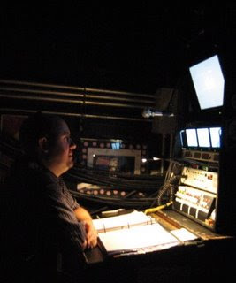
Al with Terry on the loading dock. Terry covered several vacations while we were in Vancouver - it was great to see his smiling face again everyday.


We also had our own Canadian member of the Spamily along for Vancouver. John Beatty is covering the deck electrician and pyro tech track for the 6 weeks we're north of the border. Mike Berg is home in California resting his banged up knee and will, hopefully, rejoin us in Philly. John is a Vancouverite and our very own cultural ambassador. He gamely answered all of our questions about Canada; variously explaining the Canadian government (wacky, in my opinion - the Queen is still the head of state and could wield a significant amount of power, if she so chose), Canadian Football (an extra player, bigger field, more scoring options and only 3 downs) and Canadian slang (a ceasar is a bloody mary with clam juice, eh?). And he's a good guy to boot!

The end of the stay in Vancouver bummed me out a little. I really dug the whole month and didn't want to leave - but, as Sheila pointed out: "if you wanted to stay in one place, there's an easy way to do that." By Sunday, the momentum of the show and touring had me ready to move on. Still and all, it was a pretty great month!

JV

Sunday, July 27, 2008

Grouse Grind

On Wednesday I drove out to Grouse Mountain with Elaine and Adam. Just across the Lions Gate Bridge from downtown Vancouver is a mountain resort. It's a ski destination in the winter and has converted itself to a summer time recreation destination as well. We were there to hike the trail known as the Grouse Grind.


This is the sign that greats hikers at the base of the trail.
This was merely the first time I thought to myself, "Really?"


The trail head for the Grouse Grind is at an elevation of 900 feet and climbs to the Alpine Base at 3,700 feet over the course of 1.8 miles. I can not explain how steep the trail is. For much of its length, the trail is composed of rough steps and stones arranged into rough steps. It's 1.8 miles of constant climbing. There are a few switchbacks, but no level patches.


Looking up Grouse Mountain from the parking lot. The top of the mountain was shrouded in clouds.


Adam and Elaine set off up the trail.


This sign greeted us at the quarter maker.
Again I thought to myself, "Really?" The trail had seemed extremely steep and difficult up to that point to me....


Ha! Extremely steep and difficult, indeed.

Elaine broke her foot in a skiing accident last winter, so she and I took a more leisurely (if there is such a thing) pace up the mountain. Adam was soon out of sight on his own trek. I was glad to have someone with me to share encouragement and the whole experience with.


It seemed like the halfway mark would never arrive...


The top third of the trail was crazy. Portions of the trail had ropes alongside so you could pull yourself up. Other parts of the trail would more aptly be described as a scramble than a trail. My hands were as important to getting me to the top as my feet.

An hour and half after we started up the trail, Elaine and I climbed over the top. Adam made the trip up in just about an hour and was waiting for us with a smile.

Adam greets us at the top of the Grind.

Take that, Grouse Mountain! I arrived at the top tired and sweaty, but triumphant.

I was glad for the cloud cover as we hiked up the mountain - I was plenty warm just from the exertion. The clouds were not as welcome, though, when we reached the top. On a clear day, you can see across Vancouver, the Georgia Strait and to Vancouver Island. When we reached the top we were completely socked in.

The view from the top - looking down the mountain along the tramway.

A visual representation of the Grouse Grind. Somehow, it's just not the same...


We relaxed for a bit in the Alpine House until we got our legs back. I bought both a sticker for my trunk and an "I survived the Grind" t-shirt to commemorate the experience before we started to explore the rest of the mountain. We passed up the Lumberjack Show (complete with competitive log rolling and axe throwing) but couldn't pass the stand selling "Beaver Tails". I was pleased to find yet another variety of fried dough! All the good things we had done for our bodies were probably negated by just one oblong piece of fried dough (like an ovoid elephant ear) smothered in cinnamon and sugar.


Grouse Mountain is home to a pair of grizzly bears. They were both (separately) orphaned as cubs and brought to the Grouse Mountain Animal Sanctuary. Grinder and Coola are both 7 year old males and weigh-in at around 700 pounds. They were really beautiful animals and were both up close to the fences affording us some great views. Their enormous paws with long claws made me glad for the fences - I wouldn't want to stumble upon them in the wild!

Grinder the Grizzly Bear


After our visit with the bears, we headed back down the mountain. The tram ride down was much faster than our hike up. We climbed back into the car and talked of hot showers and naps all the way back into town.


JV

Final Day Off in Vancouver

Monday morning dawned sunny and clear - a perfect day to visit the beach. I mounted my bike and started peddling toward Wreck Beach. I knew, generally, where I was headed but I didn't appreciate exactly how far it was. Vancouver is shaped, roughly, like your right hand: hold your right hand with your palm facing you and your thumb at a 45 degree angle. Downtown Vancouver and Stanley Park are on your thumb, the rest of the city is your palm and fingers with Wreck Beach out on the tips of your fingers.


Vancouver has a great system of bike lanes and trails stretching all over the city. I rode to Wreck Beach mostly along the water; first along the seawall and then on bike paths near the beautiful beaches of English Bay. The ride was really pretty. I stopped a couple of times both to rest and take in the view.


Looking back toward downtown from Kitsilano Beach.


Again looking back toward downtown, this time from Spanish Banks.
In addition to the people beaches at Spanish Banks, they had a big dog beach with all kinds of dogs frolicking in the waves.


As I entered Pacific Spirit Regional Park (part of the University of BC Endowment Lands) the bike lane left the water's edge and started to climb up a long hill. By the time I reached the trail that lead back down to the beach, I was exhausted. The trip was a little more than 8 miles. I locked up my bike and hiked down the trail toward the waters of the Georgia Strait.

Trail #3 leading down from the road to the beach.


The University Endowment Lands are 14 square kilometers of land set aside by the provincial government. Roughly half of that land is known as Pacific Spirit Regional Park and serves as a sort of greenbelt all around the University; both separating it from Vancouver and buffering it from the ocean. The park lands are mostly undeveloped. The Endowment Lands drop off dramatically down to the beach - some of the cliffs are as much as 250 feet tall. The hike down to the water was dramatic - passing through the woods on a trail made up mostly of wooden stairs. When I popped out of the woods, I was on a rocky beach known as Tower Beach.

Tower Beach takes its name from these WWII-era civil defense towers.

I hiked a little more than a mile along the beach to Wreck Beach proper (the whole beach is 4 miles long) at Point Grey. Here the beach gets wider and has big sandy stretches. It is a magnificent beach. The steep cliffs and their thick woods separate the beach from the mainland and lend it a secluded feeling. Vancouver Island separates the waters of the Strait of Georgia from the open ocean and keep them calm. From my beach blanket in the summer sun I could see the snow capped mountains in the distance - lovely.

I borrowed this aerial photo of the beach from the web - I didn't take any pictures of my own as it is a clothing optional beach and it seemed rude to walk around with a camera...

The tide was going out while I was there, so the beach kept getting bigger and bigger. The land slopes gently into the water, so I had to walk quite a ways out into the water to even reach my waist. That was fine, though, as - even in the strait - the waters if the Pacific were a bit chilly to swim in. There were several herons wading around looking for lunch and all kinds of seabirds circling overhead. Signs near the trails warned beach-goers not to disturb baby seals, but I didn't see any to disturb. Tiny crabs scuttled around the tide pools and mussels closed up tight as the tide receded.

The beach is outfitted with lots of giant logs to sit on or lean against. I set myself up leaning against one and looking out across the water. I could have stayed all day. I laid on the beach for an hour or so reading my book before the redness on my shoulders moved me back into the shade. As the sun rose higher, I enjoyed my shady spot and read a few more chapters. Around two, or so, I started the leisurely hike back up the beach and up the steps to my bike.

The ride back to the apartment went quickly - riding down the big hill was a lot more fun than the trip up had been. By the time I was nearing downtown again, I couldn't imagine peddling up one of the bridges so I rode around the end of False Creek instead of over it and stayed at sea level as long as I could. My whole trip was around 18 miles - not too shabby.

I took a brief nap and started the first of several rounds of aloe applications to my shoulders before I headed off to meet Roy for dinner. We had a relaxed dinner (and at a regular dinner hour - my favorite part of a day off) with a nice glass of wine at Joey's. After dinner, we met up with much of the Spamily at Christ Church Cathedral for a recital by our own Ben Davis. Ben performed a wide range of vocal selections in a variety of languages - he's a trained opera singer. The church was beautiful and it was so nice to hear an unamplified human voice accompanied by an acoustic piano. Michael Gribbin ably accompanied Ben on the piano and Michael was joined by Adam Souza for a couple of four-handed piano arrangements. Rick, our new sound associate, is married to a renowned player of the Chinese stringed instrument the pipa. Xiao Yu favored us with a traditional song on the pipa as a special guest at the recital as well.

After the recital several of us caught the end of the sunset over English Bay to conclude another wonderful day off in Vancouver.

JV

Saturday, July 26, 2008

Lynn Canyon

Apparently, the people of greater Vancouver really dig bridges that sway in the breeze. In addition to the Capilano Suspension Bridge swinging high above the Capilano River, they also have the Lynn Canyon Suspension Bridge undulating over Lynn Creek.

Angela took Roy, Vera and I to visit Lynn Canyon Park last Friday. Unlike Capilano, Lynn Canyon is part of a public park in North Vancouver and is free! It's part of a larger system of parks and trails known as the Baden-Powell Trail that stretches 48 kilometers along the north shore of the Burrard Inlet. Named for Lord Baden-Powell (the founder of the world scouting movement) the trail winds through the North Shore Mountains eventually arriving at Deep Cove (where we went kayaking).

The bridge was built in 1912 and hangs 165' above the river below.


My cell phone photo of the bridge

The photo from wikipedia. The bridge is quite narrow and even bouncier than the Capilano Suspension Bridge.


The four of us hiked around a bit in the park. It was quiet and really lovely in the woods. The park was not always a park - it was logged during the last century - so the trees are not as old as in other places, though they are still impressively giant. We hiked down to near the water's edge and to the Twin Falls.

The view from the bridge over Twin Falls.
(The falls are right beneath the bridge making it hard to get a photo.)


After our hike in the woods, we made a quick trip back to Deep Cove. The stated reason for the trip was to show Roy how cute Deep Cove was, but we were actually there for honeydonuts. Vera and Angela tasted these fried pieces of goodness apre-kayak and took us all back for more. It was well worth the trip. I'm not sure how they infused a donut with honey, but it was amazing.


The whole adventure was over by lunch time (as Angela had to supervise the wardrobe work call at the theatre). Roy and I took the rest of the afternoon to visit Granville Island. As we wandered the market, we picked up all sorts of items to turn into dinner. A pear and goat cheese ravioli looked too good to pass by. The produce stands had all the fixings for a big salad. The pastry counter had too many good looking desserts to wait until after dinner - we split a tart between us on the waterfront before our ferry ride back to the mainland.


Friday was a very pleasant and relaxed day with friends.


JV

Friday, July 25, 2008

Deep Cove

Last Wednesday Nate organized a Spamily kayak outing. About 20 of us treked across the bridge to North Vancouver and to the hamlet of Deep Cove. Situated at the base of Mount Seymour, Deep Cove is a small community on an inlet of the Indian Arm fjord. The fjord was created during the last ice age and is a branch of the Burrard Inlet that forms Vancouver's inner harbor. The mountains rise dramatically up out of the water on both sides of Indian Arm and make for some beautiful surroundings.


The view from the shore of Deep Cove


We were outfitted with touring kayaks, life-jackets and other supplies by the good people of Deep Cove Canoe and Kayak. They gave us a 5 minute kayaking lesson and then set us loose on the water. We didn't have a guide - just instructions to keep together and have fun.


Suiting up and preparing


Paddling out


We set out paddling north from the cove and into Indian Arm. Very quickly, the view became more pastoral. The steep mountain-sides don't leave a lot of room for people. A single road traces the shoreline north from town with a row of houses along the water's edge. The view that these homes have must be brilliant - of course, you also have to share it with groups of laughing amateur kayakers occasionally...


A mile, or so, into the trip we passed a small lighthouse on its own island.


After we rounded the lighthouse, I could really feel the wind at our backs pushing us along. We started to spread out along the eastern side of the fjord with the more adventurous at the head of the group and some more laid back paddlers bringing up the rear. The leading edge of the group paddled about 3 and half miles from our put-in point and got a spectacular view of the snow-capped mountains at the north end of Indian Arm. I hung back a little bit and explored the shoreline. Small rivers and streams poured into Indian Arm at a couple of places along the trip making pretty waterfalls. I also sat and watched a crab boat pull crab pots for a while.


When it was time to head for home the wind was in our faces, making the trip back to the beach much more of a workout. The water had a little more chop to it on the return trip, but the views were no less beautiful the second time. I was grateful, though, to round the lighthouse and feel the winds lessen a bit as the mountains shielded me. My whole trip ended up being something like six miles - that was quite a workout!

Francesca paddling


As I climbed out of my kayak my camera dropped out of my life-vest and into about 2 feet of water. I rinsed off the salt water and let the camera dry for a couple of days, but the dunking had ruined the camera. Francesca was able to salvage the photos on the memory card, but I'll have to send the camera in to be repaired. Fortunately, the extended service plan I bought with the camera covers such mishaps and I should be able to get a new one soon. Unfortunately, Ritz camera doesn't have outposts in Canada, so it's still a little up in the air how, exactly, I'll have to handle the transaction. Until then, my blog will be a little less photo intensive and I'll be using my phone's camera more and relying on friends to share their photos.


JV

Tuesday, July 22, 2008

My Day Off - Part 4 (English Bay)

To wrap up the day off, David and I walked up to the beach at English Bay. We got some Starbucks and some snacks, found a big log on the beach and settled in to watch the sun set over English Bay and behind Black Mountain.

I took nearly 100 photos of the sunset and have culled it down to around 30 in the computer. The dozen or so below speak for themselves. The captions indicate the time I took the photo.


8:55 PM


8:58 PM


9:01 PM


9:07 PM


9:13 PM


9:17 PM

9:19 PM

9:26 PM


9:35 PM


9:38 PM


9:59 PM


10:00 PM


We sat on the beach for nearly an hour and a half enjoying the natural beauty of the sunset. It was so lovely just to sit and enjoy it with a good friend like David. Of course, the beach was full of other folks also enjoying the show. The couple two logs down from us especially enjoyed themselves.


I felt super guilty taking this photo of them making out on the beach at sunset. Instant karma came and got me - I forgot to turn the flash off. Whoops. It didn't seem to bother them, though. They hardly came up for air the whole time we were there. God bless them.


It was a lovely ending to a really wonderful day off.


JV

Monday, July 21, 2008

My Day Off - Part 3 (Whistler Air)

The four of us rendezvoused in Whistler Village and boarded a van that took us to the airport for our flight back to Vancouver.


In conjunction with our train tickets, we also booked a flight on Whistler Air back to Vancouver. We would be flying on a float plane taking off from Green Lake and landing right in Coal Harbour along side the cruise ships and giant container ships.


Our plane was the largest one at the dock with seating for 12.


The same guy who picked us up in the van, flew the plane! He arranged our seating in the plane to evenly distribute our weight. The pilot asked for a volunteer to sit up front in the co-pilot's seat and I may have actually jumped up and down saying: "Pick me! Pick me!"


It only took a few minutes to get us all settled and strapped in. Of course, there were no flight attendants, our pilot was also the cabin attendant and our DJ. We all wore headsets both to block out the noise of the engines and to allow the pilot to talk to us. His I-Pod was jacked in to the com so he also played music for us!

After a quick phone call to air traffic control, we were riding across Green Lake and then we were airborne.


Our flight took us up alongside Blackcomb, over Whistler Mountain, and through the mountain range. We flew at the level of the mountain tops, making the views absolutely amazing.


Our pilot also pointed out some sights (including some bears on the ski trails below). Black Tusk is the name of of the mountain pictured below. It's the remnant of the vent of an ancient volcano. The volcano was first active more than 1.1 million years ago. Around 170,000 years ago (after the glaciers receded) the volcano rose to it's peak before becoming dormant. Since then, the rest of the vent (probably made of softer ash) has weathered away leaving only the dramatic spire of black volcanic rock now known as Black Tusk. At 7,600 feet tall, it's visible and easily identifiable from all around. According to the legends of the local Indians, Black Tusk is the home and nesting place of the Thunderbird.


The area around Black Tusk was once a very active area for volcanoes. Though the last major eruption was more than 2,000 years ago, the evidence of the volcanic activity is everywhere. The Table or Table Mountain was created when an ancient volcano erupted under a glacier in the Holociene era. The magma forced its way upward in a cylindrical shape but never broke through the ice sheet. The magma cooled to form Table Mountain - gravity kept the top of the hot magma flat.


Mount Garibaldi is the most dramatic mountain in the portion of the range we flew through. Also formed by volcanic activity, Mount Garibaldi towers around everything else at more than 8,700 feet. It is a potentially active volcano - meaning that it has not erupted in historic times, but it has active lava chambers within it. The mountain is home to two significant glaciers. The one pictured below is the Diamond Glacier. The views of the glacier from the air were nothing short of amazing. Deep cracks in the snow and ice seemed bottomless. Huge hunks of the glacier had broken off leaving ragged edges in their wake.


Shortly after we passed by Mount Garibaldi, the fjords of Howe Sound came into view. The fjords were created as the glaciers retreated and carved deep channels between the mountains. The mountains come right to the edge of the sea and drop dramatically in. The fjords of Howe Sound are the southern most fjords in the world.


Soon, Vancouver was peeking out between the mountains.


After all the mountains, the flatlands that make up Vancouver were quite a surprise. The waters of the sound and Burrard Inlet were the first hint that we were near the Pacific. Our pilot contacted air traffic control for Vancouver Harbour and a few minutes later we were touching down in the waters of Coal Harbour.


The whole flight only took about half an hour, but it was such a dramatic time. I was lucky to sit up front and have such a great view of the beautiful surroundings.

One more instalment to come -


JV